Charting
Charting
Orange Marine Charting Department provides a comprehensive service from preparation to post-operation.
Before the installation: desktop study and surveys
As part of the response to tenders for installing a liaison, Orange Marine conducts studies on the routes provided by the customer or proposes to create new routes to connect different locations.
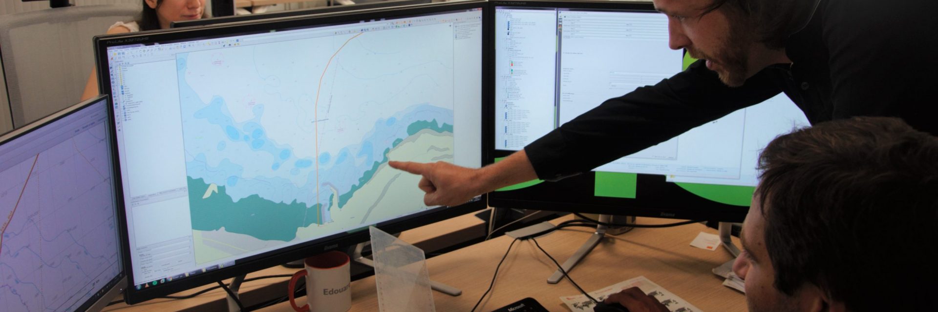
These analyses are conducted using several GIS – Geographic Information System.
Desktop Studies
These studies are based on archives, without operation at sea. They aim at providing accurate GIS data, marine charts and activity information to create or adjust cable routes.
After this study Orange Marine provides:
- detailed Route Position Lists – RPL – with precise details of all the necessary cable route events, coordinates, depth, final cable quantities adjusted for correct slack values
- Straight Line Diagrams
- charts and technical plans
- path profiles along routes
- data issued from treatment and analysis of the study
- surveys
Orange Marine offers survey services to complete the Desktop studies information. The survey is a key part of the initial phase of cable routing.
Orange Marine worked in partnership with IFREMER (opens in a new window) – French Research Institute for Exploitation of the Sea – to conduct TAT12/13 surveys for BT.
Find out more :
- Engineering
- Survey
After the laying: reporting and comprehensive installation report
The technical teams in charge of the installation provide the customer with a comprehensive report. The Charting Department develops a complete set of maps provided to customers within a month after the end of the operation. The initial survey charts are updated with As Laid route and burial information. The survey charts with final installation data – such as burial means (plough, ROV, crawler, divers) – are integrated in the internal cable database.
Management of Charts Database
Orange Marine maintains a cable route database. Adjustments to routes or elements are made in real time at each installation operation or maintenance – repair, change repeaters, re-trenching, etc..
This comprehensive database also includes information about cables laid and repaired by third companies, as well as other subsea installations, such as gas or oil pipelines, power cables, offshore wind fields, etc.
Orange Marine uses this database internally for business operations, but also to provide customers and Orange Group with updated information.
On the basis of these data, the Group shall provide information for:
- updating the website SIG Cables (opens in a new window), aiming at informing fishing vessels about submarine cables, giving advice on precautions to be taken when crossing a cable route, and providing the procedure to follow when accidentally hooking a cable.
- Information of international carriers about cable crossing areas, especially when they have installation projects
- response to requests from ministries – including the Ministry of Ecology, Sustainable Development and Energy – or design offices about the position of submarine cables.